Map Documentation: Poultry Farm Discovery (BDN)
-
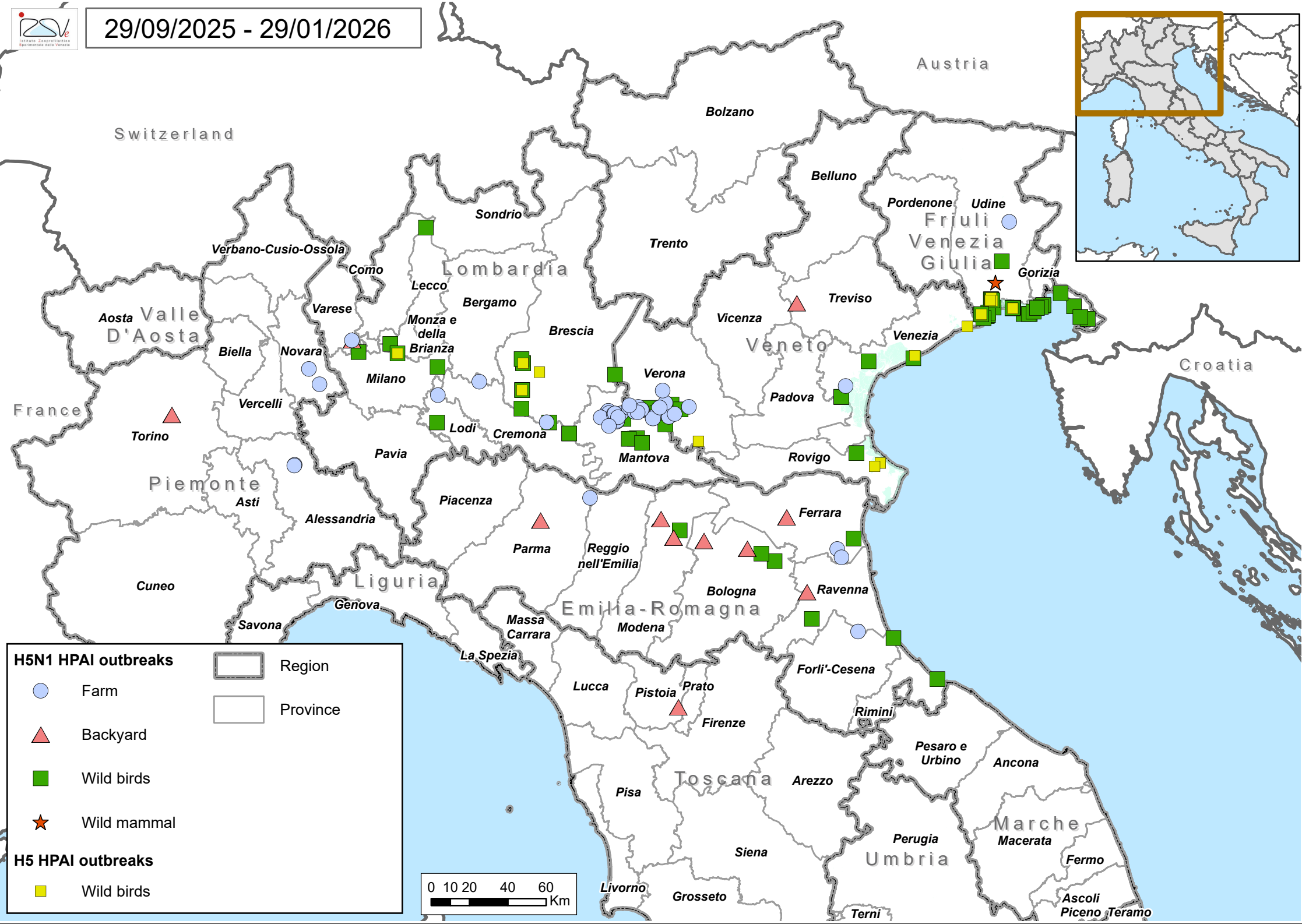
Detailed Avian Influenza Outbreak Map
Abstract
This dataset provides a comprehensive list of **valid**, **open**, and **closed** poultry farms registered in the National Data Bank (BDN). It specifically filters for farms categorized as 'Breeding' (AL) or 'Mixed' (MS) across Italy.
The data is processed through a join between the poultry breeding facts and the 'Places' (Luoghi) dimension (filtered for valid/open locations). It also incorporates owner/holder details via an outer join with the 'Registry' (Anagrafe) dimension and housing data via the 'Poultry Housing' (Accasamenti) dimension.
General Details
- Owner: IZSVe - Istituto Zooprofilattico Sperimentale delle Venezie
- Source: National Data Bank (BDN) - DWH Fact: ALLEVAMENTI_AVICOLI
- Publication Date: 2017-01-01
- Destination:
- GIS Instance
- WebGIS
- Influenza Monitoring Portal
- Coverage Area: Italy (National territory)*
- Coordinate Reference System: EPSG:32632 (WGS 84 / UTM zone 32N)*
- Geographic Unit:
- Municipality (ISTAT)
- ASL Competence Districts
Online Resource
| Field
|
Value
|
| Linkage
|
Download Map_0001.png
|
| Protocol
|
HTTPS / Wiki File System
|
| Function
|
Download
|
| Format
|
image/png
|
| Description
|
Detailed resource for the specified geographical area.
|
KeyWords